

Colorado's Abandoned Towns Animas Forks - High Mountain Ghost Town

Updated: Oct 27
Site Visit Date: September 4, 2026
Colorado's Abandoned Towns -- Better Known as Ghost Towns.
Today's Town: Animas Forks
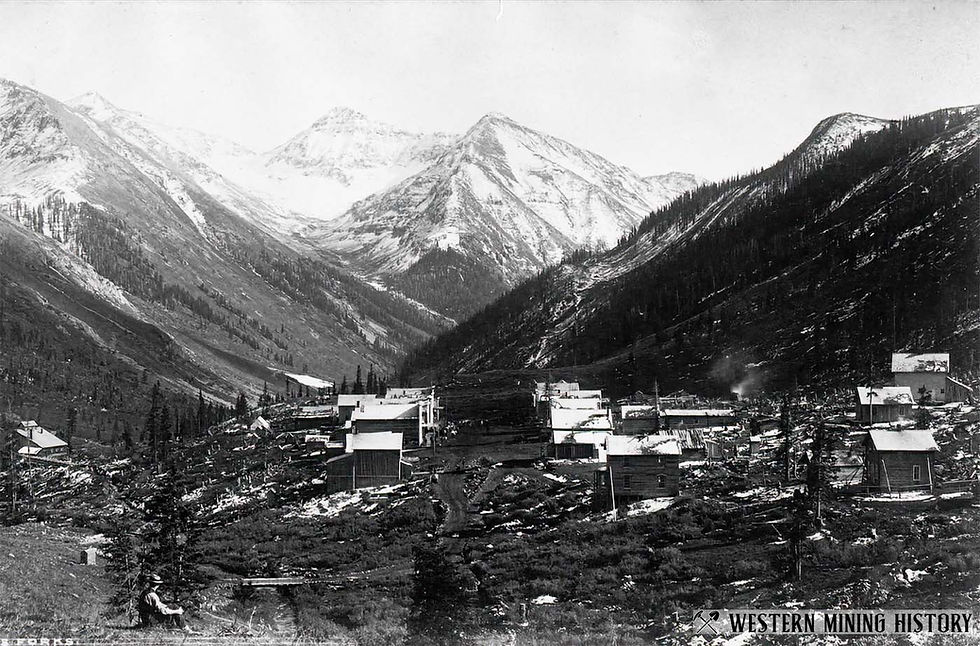
Today, my husband, our dog Harley, and I drove our Jeep into the San Juan Mountains to explore the historic mining town of Animas Forks and its guiding question.
What did it take to call a place home when winter could
cut it off from the rest of the world?
High in Colorado’s San Juan Mountains, where the confluence of the Forks of the Animas River sits, is the historic townsite of Animas Forks. The San Juan County townsite is along the Alpine Loop Back-Country Byway—the popular 65-mile scenic off-road route connecting the historic mountain towns of Lake City, Silverton, and Ouray. The route crosses two major mountain passes above 12,000 feet: Cinnamon Pass (12,600 ft) and Engineer Pass (12,800 ft).
HISTORY OF ANIMAS FORKS
The historic town of Animas Forks, about 12 miles northeast of Silverton, Colorado, sits 11,200 feet above sea level at the confluence of the forks of the Animas River.
The area, prospected for silver and gold, developed and became known for its hard rock silver and gold prospecting, mining, and milling. The town witnessed the dramatic booms and busts of hard rock mining for over seven decades.
In 1873, prospectors built the first cabin in Animas Forks.
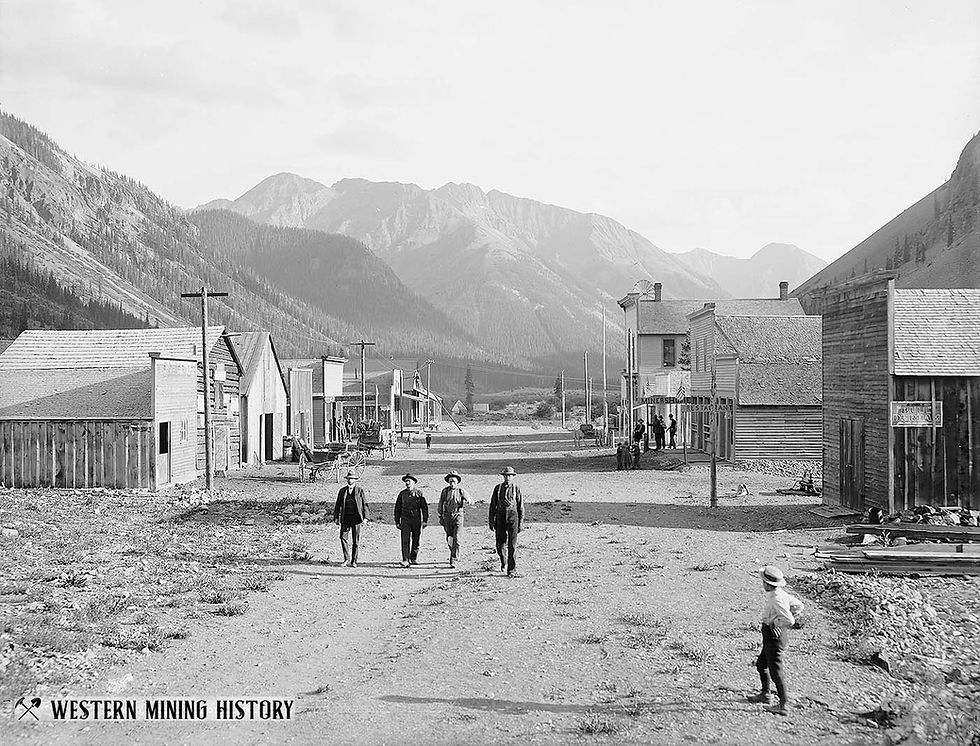
By 1876, the settlement had grown into a community of approximately 25 cabins, along with a hotel, general store, meat market, saloon, blacksmith shop, assay office, restaurant, sawmill, smelter, and post office. By 1883, the BLM recorded 450 residents.

The three-story Gold Prince Boarding House became part of the town in 1905 and housed approximately 150 workers from the Gold Prince Mill until 1910.
The Animas Forks Pioneer began publication in 1882 and continued until October 1886. At about 11,200 feet, it was the highest-altitude printing plant in U.S. history. It gave the isolated settlement its own newspaper.
Building the town here put residents near mining activity, but the elevation and distance from other towns made travel and winter living difficult. In the fall, many residents migrated south to the warmer town of Silverton to avoid the long, isolating winters.
A documented 23-day blizzard in 1884 brought a reported 25 feet of snow, forcing residents to dig passages between buildings.
The Silverton Northern Railroad connected the town with Eureka and Silverton in 1904. The railroad right-of-way now serves as the county road leading into the town.

THE GOLD PRINCE MILL
The Gold Prince Mill at Animas Forks had about a 500-ton per day capacity, with 100 stamps, but reportedly never operated at capacity. Stamps are mechanical devices that crushed ore. The mill processed ore carried by a 2.4-mile aerial tramway from the Gold Prince Mine in nearby Placer Gulch.
It developed during the early-1900s mining revival and was operating by 1907. By 1910, it had shut down.
The Gold Prince Mill briefly renewed employment and building activity in Animas Forks, processed ore from nearby Placer Gulch, and connected that production to the railroad network through Eureka and Silverton. After its closure, much of its equipment found a second use in Eureka in 1917.
THE PEOPLE
William Duncan, twenty-seven, arrived in Animas Forks with hopes for a bright future for his family. Duncan and his wife Mary built a family home in 1879 for their family, including six-year-old Mary, five-year-old Sarah, and their infant son, Willie Grant.
The 1880 census lists Duncan’s occupation as a hardrock miner. Reportedly, William was one of the first miners to live in Animas Forks year-round.
The Duncans must have been resilient to endure snowstorms bringing up to five feet of snow and periods of below-zero temperatures. They reportedly left Animas Forks in 1884.
The Gustavson family also made their home here. From Sweden, Charles Gustavson, and his wife, Alma, from Finland, came to Animas Forks in 1906. Employed by the new Gold Prince Mill, Charles was a mill and tram worker and built their house in 1907.
People called their house the one with an indoor toilet—Charles constructed a closed hallway to the outhouse apart from the house.
The marker in the house states that their son, Carl, arrived prematurely while living in a tent in Animas Forks before they built the house.
I can’t imagine giving birth in those conditions.
The Duncans and Gustavsons were only two of the families who made their homes in Animas Forks. Other residents established businesses, operated mines, and helped transform a remote mining camp into a community.
Many artifacts were found in Fred and Sadie Coomb’s house, including flaked stone tools left by the very first inhabitants, the Ute Indians.
William Erickson, the general manager of the Columbus Mine and Mill lived in the Hip Roof House in 1948 with his family. They were among the last occupants of Animas Forks.
Henry Warren Cabin – His log structure is one of the oldest buildings in Animas Forks. It was one of the few Main Street buildings that survived the 1891 fire.
Brothers Edwin and Squire Brown, established the Kalamazoo House hotel in 1879.
Edwin Brown, Levi Woodbury, and Harrison Garrison were reportedly partners in a water-powered sawmill established in 1878.
Esther Ekkard—a boarding-house operator, who reportedly extended credit to miners.
The Stein Brothers were also residents of Animas Forks. Their residence was a small log cabin. They also owned Stein Bros. general store and the Stein Bros. saloon. These buildings are no longer standing.

THE TURNING POINT
In 1891, a fire in the kitchen of the Kalamazoo House destroyed the hotel and thirteen other buildings. The 1893 silver crash dealt a harsh blow. Mining profitability fell; a mill-led revival began in 1904, but the Gold Prince Mill closed in 1910.
OUR VISIT
Partly cloudy skies greet us on the day of our visit. The road into Animas Forks is part of the popular Alpine Loop Back County Byway. The road is rocky and we’re limited to a slower pace than the graded-gravel road which took us to Howardsville and Eureka.
Just before our arrival at Animas Forks, a marmot sat on a rock. As we rounded the curve near his seat, his high-pitched warning whistle grew louder. Now I understand why they are also called Whistle Pigs.

When we arrive at Animas Forks, the townsite is bustling with visitors. Jeeps and OHVs occupy the parking spots near the restrooms and the town's parking area.
The drop in temperature is noticeable, but I’m comfortable in my long sleeve shirt. Any cooler and I’d have needed a jacket.
First Impression
The townsite is larger, better preserved, and easier to explore than I had anticipated. Visitors wander along paths leading to the historic houses, several of which are open for exploration.
Although not near the other houses, my first visit was to the jail. It’s smaller than I’d imagined, with one barred window and a solid door, making a breakout difficult.
Interpretive signs are placed at the beginning of the path to the houses, giving information about the town and the buildings. The townsite sits above the road, requiring a short uphill walk to reach the houses.
As I stood where the town had stood, I looked south toward Silverton.
The view was incredible—mountain peaks, a lush green valley, the river winding south toward Silverton.
I could only imagine how beautiful those peaks were in winter, with snow covering them.
Yet, I could also imagine the chilling winds blowing up the valley right into the town. It would have made the town freezing cold during those winter storms.
What Remains Today
Today, nine primary structures remain intact, including the iconic two-story Victorian-style William Duncan House, Gustavson Home, the timber-built jail, and the Columbus Mine cabins.
The stone and wood foundations of roughly 25 homes and businesses line the hillside, alongside the remaining foundations of the massive Gold Prince Mill. The stone foundation of the Gold Prince Boarding House remains as well.
Preservation efforts have given Animas Forks a future that many abandoned mining towns never received. Through cooperation among the Bureau of Land Management, San Juan County, historical preservation organizations, and grant providers, several surviving structures have been stabilized and restored. Those efforts allow visitors to explore buildings that might otherwise have disappeared beneath decades of mountain snow and exposure.
Crews stabilized failing walls, replaced historically accurate roofs (such as the jailhouse design), and repaired rotting foundations as part of the structural stabilization.
Workers added shatterproof polycarbonate windows, matching wood siding, and weather-sealing wood stains to withstand extreme alpine winters as part of the weather-resistant upgrades.
Planners installed interpretive signs, maps, and designated parking areas to manage hundreds of thousands of 4WD tourists while protecting fragile historical artifacts, to allow for visitor integration.
Near the townsite are the remains of the Columbus Mill, built in the 1920s to process ore from the nearby Columbus Mine. The mine produced lead-rich galena ore containing relatively little silver.
Although historical accounts differ on when mining operations ended, Colorado Bureau of Mines records identify Columbus among the producing mines in San Juan County as late as 1953. The townsite's interpretive marker also reports that ore was processed at the Columbus Mill during the 1950s.
WHAT SURPRISED ME MOST?
Probably the Duncan House.
A Victorian-style home built at 11,200 feet in 1879 must have been a marvel. The interior of the house showed a well-thought-out floor plan and room for a family.
I could have lived in that house, but not at 11,000 feet.
I was expecting small cabins with very low ceilings, small rooms and fewer of them. This house did not meet those expectations. The taller ceilings and spacious rooms seemed out of place in such a remote mountain settlement.
The design of the house gave me a glimpse into the man William Duncan must have been. Perhaps a forward thinker, visionary even, someone who wanted to plant roots, and maybe, a man who wanted his family to be comfortable.
BEFORE YOU GO
Location: San Juan County, on the Alpine Loop above Silverton.
Elevation: About 11,200 feet.
Road / Access: Unpaved mountain roads; conditions vary with snow, storms, and maintenance.
Recommended Vehicle: From Silverton to Eureka CR2 is a graded-gravel road, from Eureka to Animas Forks is part of the Alpine Loop which is narrower and rockier. The BLM indicates that the summer approach from Silverton can be passable in a two-wheel drive to Animas Forks. However, traveling on the Alpine Loop beyond Animas Forks over Engineer Pass would require a high-clearance vehicle.
Walking Difficulty: The walk along the path toward the town is an incline but not terribly steep. A few other paths also have inclines. Several of the paths are level. Of course, the elevation should be taken into consideration especially for guests who are not accustomed to high elevations.
Best season: Generally mid- to late summer into early fall, depending on snow and road conditions.
Cell Service: Map your route before leaving; service may be unreliable.
Facilities: Animas Forks has male/female restrooms and designated parking near both the restrooms and the townsite.
Colorado OHV Requirements: Colorado requires appropriate registration or permits for off-highway vehicles. Certain designated OHV trails also require permits for street-legal vehicles. Check current requirements with Colorado Parks and Wildlife before traveling.
Note: Park Rangers were checking for permits the day we visited.
Private property: Respect all posted boundaries, restrictions and environmental restoration areas.
Weather Concerns: Mountain weather can change quickly; check current conditions before leaving. Rain or snow can be hazardous on mountain roads without a 4 x 4 vehicle.
Mine / Structure hazards: Do not enter mine openings or climb on unstable historic structures
Preservation: Do not remove artifacts or objects from historic sites
Take only pictures. Leave only footprints.
THEN & NOW
WHAT DID ANIMAS FORKS LEAVE BEHIND?
Animas Forks secured its place in Colorado's mining history, but it also left something more tangible.
Unlike many abandoned mining towns, where little remains beyond scattered timbers and stone foundations, Animas Forks offers visitors a glimpse of what life once looked like in this remote mountain community.
Without the dedication of preservation organizations, these buildings might have fallen victim to the elements long ago.
Instead, thousands of visitors walk the paths, step inside the surviving homes, and imagine the lives of the families who once lived here.
Not long ago, while attending a dinner, I was talking about my visits to Colorado's abandoned mining towns. A woman who overheard our conversation shared something unexpected.
Her husband had proposed to her inside the Duncan House at Animas Forks!
I asked her permission to share that memory in this post, and she graciously agreed.
It struck me that more than a century after William Duncan built that house for his family, it had become part of another family's story.
Animas Forks may no longer be a place people call home, but it's still a place where memories are made.
THE QUESTION IT LEFT ME
I’m still left with Animas Forks’ original question:
What did it take to call a place home when winter could
cut it off from the rest of the world?
Some left.
They migrated to Silverton for the winter.
Others stayed, adapting to whatever the mountains brought their way.

Perhaps calling Animas Forks home meant knowing when to leave and when to stay. Either decision required determination and a willingness to adapt.
For those who remained through the winter, ingenuity wasn't simply an admirable quality. It was a necessity.
Like the Gustavsons, who enclosed the passage to their outdoor toilet.
That kind of ingenuity.
LEARN MORE
Bureau of Land Management — Animas Forks: visitor access and a concise historical timeline.
History Colorado — Animas Forks Town: historic significance and preservation context.
National Park Service — Animas Forks National Register record: historic district documentation for deeper research.
PREVIOUS STOP: EUREKA
NEXT STOP: CAPITOL CITY
What happens when one person imagines a mining camp as the capital of a state?

Thank you for reading.
May God abundantly bless you and may He always keep you.



Comments